


Book Tickets Online
About
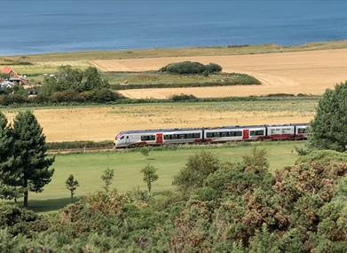
Not a cycle route but the Bittern Line is a cycle friendly railway line operated by Greater Anglia. The line links Cromer and Sheringham with Norwich and the Norfolk Broads. It has a special map showing linear and circular cycle routes from its stations, using country lanes.
Links: North Walsham, Gunton and Cromer stations link with the Quiet Lanes. Other links are with the Norfolk Coast Cycleway at Gunton and Cromer, the Bure Valley Railway and Path and the Norfolk Broads at Hoveton & Wroxham, the Paston Way at North Walsham and the Marriots Way and National Cycle Network 1 at Norwich.
Facilities
Accessibility
- Disabled access
Children
- Children welcome
Map & Directions
Road Directions
By Road:Car parks available in all towns and serve some stations along the Bittern Line. Nearest railway stations: Bittern Line Norwich, Salhouse, Hoveton & Wroxham, Worsted, North Walsham, Gunton, Cromer, West Runton, Sheringham.


