


The Deep History Coast trail has nine sections that can be walked in single parts or as longer distances. We’ve picked five which would work for families with younger children. If you don’t want to walk back, check out the Coasthopper bus which has a regular service along the coast in the summer. At each start and finish and along the way, the Deep History Coast App can tell you about the life of early man and what kind of animals roamed the land.
Sheringham to Weybourne. This section of the trail could be done starting at Sheringham where there are plenty of places to park and the chance to get the steam train back from Weybourne as an added attraction. It’s three miles so still a hike for younger children, though you should be OK with a pushchair. It’s mostly a reasonably flat track, though the gentle slope into Sheringham means an uphill start if you’re doing it the way we suggest. You’ll be able to spot the ancient chalk reefs, Robin’s Field, just offshore at Sheringham and walk along the Cromer Forest Bed further along towards Weybourne on the crest of the cliffs. For snacks and drinks there’s the Village Store and Buns Tearoom at Weybourne.
.jpg)
East to West Runton. This is a much shorter route at just 1.25 miles along flat paths, tracks and pavements, with a short section along the road. The beauty of this section if you go from East to West Runton there is the promise of some rockpooling once you get there, plus there’s a couple of pubs, café and a chip shop at West Runton too.
From East Runton, there’s a short section along the road, before the path heads across a wildflower meadow. The rest of the route follows the clifftop edge, with a few diversions where parts have been lost to the sea. Check out the chocolate brown, fossil-studded layer at the base of the cliffs, called the West Runton Freshwater Bed, which is 720-650,000 years old.
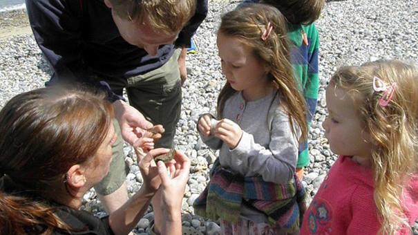
Rummage among the rock pools and the sand at West Runton, and you may find fossils of sea urchins that are over 90 million years old – they don't look much different to the sea urchins that live in the sea today. The rock pools have limpets, crabs, sea anemones and starfish with their own miniature seas in which to wait out the tides. Use the Deep History Coast App to identify any fossils you find or see our fossil identifier guide.
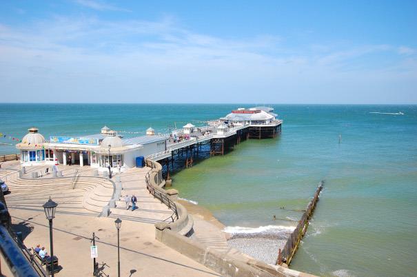
East Runton to Cromer. This is another shorter section of 1.25 miles with flat grassy paths, tracks, tarmac paths and brief roadside walking. It starts at East Runton, where there is parking and more information about the Deep History Coast. Just east of the junction, along the A149, the route forks left and leads through a caravan park before dog-legging along another short section of the main road then returning to the cliff tops. Once back by the coast it doesn't take long before Cromer comes fully into view. The grassy path joins the start of the genteel promenade that leads into the town itself, arriving at the entrance to the pier. Cromer has eating places and attractions aplenty, from amusements to Cromer Museum, where youngsters can see some of the fossils which have been found along the coast.
The Cromer Forest Bed is beneath your feet and, to the south is the Cromer Ridge, which was formed around 450,000 years ago, when massive ice sheets from the north and west bulldozed a jumble of sands and gravels ahead of them as they pushed south. The pier is definitely worth a visit, including the lifeboat station at the end, which is open to the public.
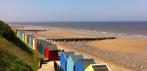
Mundesley to Walcott. This is a slightly longer route, three miles, but if you start at Walcott, there’s the promise of ice cream or chips and crazy golf in Mundesley. The beaches at both ends are great for picnics and there’s toilets at both places. Walcott also has chips, café and ice cream. If you like walking on the beach, there is firm sand most of the way plus concrete sea wall promenades, and its completely flat. Please check tide times as the route is not accessible at high tide, with no official alternative route. There are breakwaters along the route with gaps and low sections where you can cross, although you may have to weave across the beach between them as they don't always follow a straight line.
Walcott to Happisburgh. This route is 1.75 miles of pavements, with a grassy cliff top path that can be muddy, although it is virtually flat. This part of the coast has suffered serious erosion so there may be a few diversions where the cliff has fallen.
There are plenty of places to park in Walcott, though it does get busy in the summer. There are toilets at both ends of this part of the trail, plus chips and café at Walcott and a pub at Happisburgh. The route goes through Walcott and a small housing estate on its way to the now-low cliff tops.
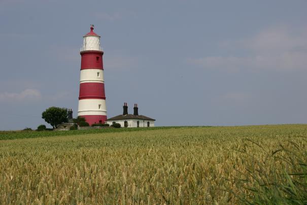
At Happisburgh, the path passes through a caravan site on the western edge of the village, then crosses meadows to reach the car park and toilets at its eastern end. Happisburgh’s landmark is its lighthouse overlooking the sea, which has open days during the summer. Coastal erosion is particularly voracious along this part of the coast, and some estimates put the loss at around 2km of land in the last 2000 years.
In 2000 an unusually shiny, ebony-black piece of flint that was found sticking out of the mud below the high tide line turned out to be a 500,000 year-old, skilfully carved hand axe – one of the oldest ever found in north-western Europe. And, in 2013, the sea stripped away the sand to expose the footprints of a family that had strolled this way, just as you are perhaps doing now, over 800,000 years ago. The Deep History Coast App will tell you more about the area through the Hominin family.
Related
Comments
Comments are disabled for this post.
