To provide you with the best experience, cookies are used on this site. Learn more

To provide you with the best experience, cookies are used on this site. Learn more


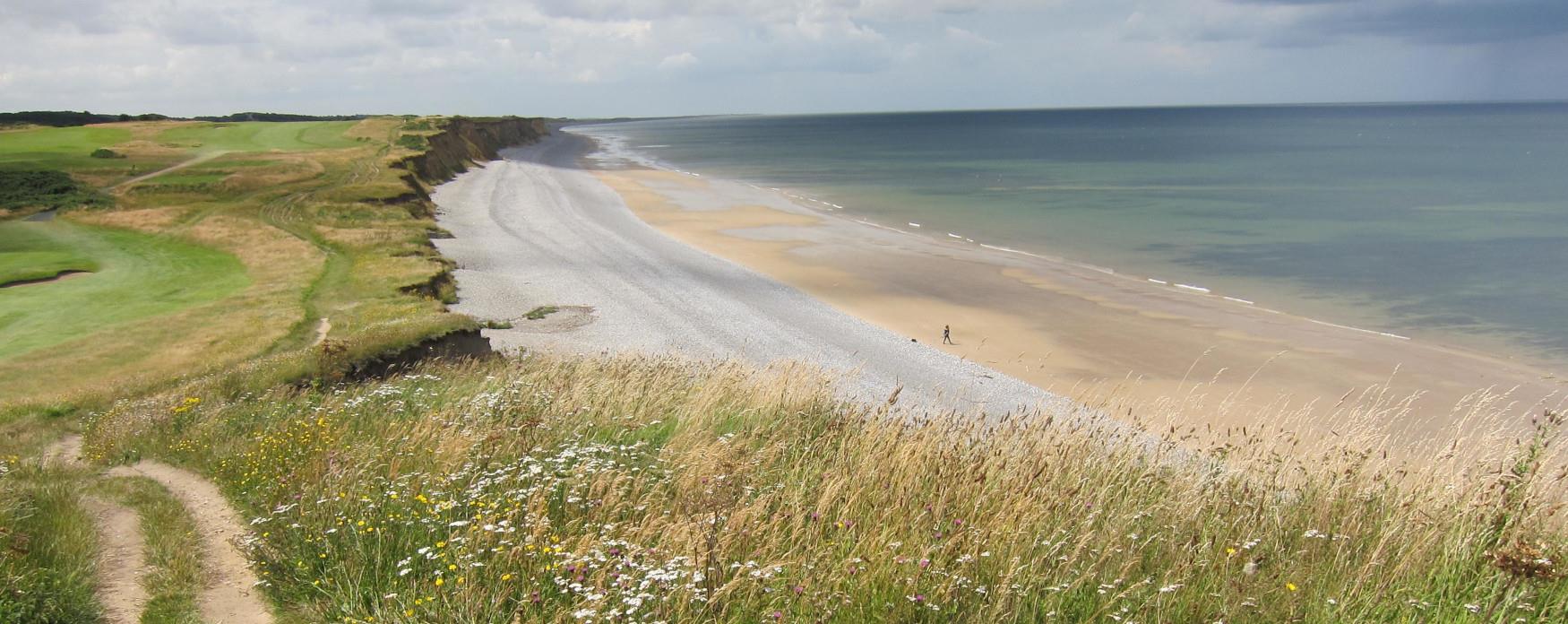
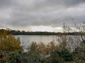
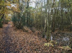
Walking Route - Brancaster: 4.5 miles / 7.25km
Modern Brancaster is a sleepy coastal village, albeit one with a vibrant sailing scene. This circular walk offers a rich and varied past for the heritage explorer to delve into. Why not finish the walk at one of the local pubs, which have a history all of their own?
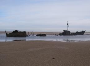
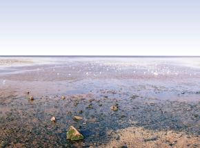
Shipwrecks and Salvage
When the numerous ports of north-west Norfolk’s coast were still busy with trading ships, smuggling and piracy were also commonplace. Shipwrecks provided coastal communities with unexpected, and often irresistible, opportunities to obtain valuable goods.
In September 1833 such an opportunity arose at Brancaster. The packet ship Earl of Wemyss, en-route from London to Edinburgh, became stranded on a sandbank during a storm. The male passengers and crew got ashore and were accommodated at the Ship Hotel, but eleven passengers were left behind, the women and children told by the crew to stay in their cabin. As they waited for rescue though, the waves crashed in through an open skylight and tragically they all drowned.
The Lord of the Manor sent his son-in-law, Joseph Newman Reeve, to supervise salvage efforts. When the bodies of the deceased were laid out in St. Mary’s Church they had already been searched and their clothes and valuables removed. On 26 March 1834, Newman Reeve went on trial in Norwich charged with stealing the property of the deceased, but he was eventually found ‘not guilty’ of the crime.
Two of the victims, Miss Susanna Roche and four-year-old Alexander Roche, share a grave in the churchyard of St. Mary’s in Brancaster. The worn inscription on their headstone laments that ‘their persons were stripped of every valuable and their property plundered’. The grave of Joseph Newman Reeve is just a short distance away.
St. Mary’s Church also displays the only service board of the Brancaster lifeboats, which operated between 1874 and 1935. The first chairman of their committee was the son of Joseph Newman Reeve.
The Brancaster Circular Walk passes the Ship Hotel and St. Mary’s Church. It continues toward the Royal West Norfolk Golf Club, built near the site of the old lifeboat house. Returning inland, it passes the round-towered church of St. Mary’s at Titchwell, and the medieval village cross. Titchwell chalk pit is also accessible from the trail. Once used as a dump, it has now been transformed into a mini nature reserve.
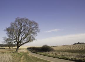
Walking Route - Brancaster Staithe: 5 miles / 8km
The Brancaster Staithe walk is a contrast of saltmarsh and sailing regattas, wind and woodland. The views from the highpoint at Barrow Common are breathtaking. From here it is easy to picture traders visiting Branodunum, the Roman fort built near the shore to defend the coastline.
Ancient Origins
The Bronze Age, the Roman occupation, and the Saxon and Norman periods all left their mark on the landscape around Brancaster Staithe. Each chapter in the village’s history has left us with a fascinating archaeological record that has helped enhance our understanding of north-west Norfolk’s history.
One mile to the south of the village lies Barrow Common, the site of a small hill presumed to be a round barrow. These mounds of earth were raised over places of burial during the Bronze Age, mostly between 2200 BC and 1100 BC. Middle to Late Bronze Age pottery has also been found on the site.
The Roman fort of Branodunum sits between Brancaster and Brancaster Staithe, and is accessible from this route. The fort was one of the Saxon Shore forts constructed along the south and east coasts of England. They were built to prevent seaborne invasion by the Frisians, Angles and Saxons from across the North Sea. The fort developed in several phases from around 200 AD but was abandoned around 400 AD as Roman rule in Britain came to an end. The walls were eventually dismantled in the 1700s, with stone being incorporated into several buildings around the parish.
Immediately to the east and west of the fort lay two vici or Roman civilian settlements. Detailed excavations in the 1970s, along with a series of aerial photographs, revealed many artefacts and helped archaeologists map their layout. The western area is now covered by a modern housing estate.
Fragments of Saxon pottery, a brooch and a comb have been found in Brancaster Staithe, and the round-towered St Mary’s Church at Burnham Deepdale is believed to have Saxon origins. The church’s nave houses a beautifully designed Norman font which details the ‘Twelve Labours of the Months’, with depictions of seasonal activities such as digging in March, mowing hay in July and feasting in December.
The route of Brancaster Staithe Circular Walk crosses Barrow Common as well as passing the sites of the Roman settlements and fort. St. Mary’s (Burnham Deepdale) is also within a few steps of the trail.
Walking Route - The Burnhams: 4.5 miles / 7.25km
Following in the footsteps of two of Norfolk’s maritime heroes, this stunning route visits three of the historic ‘Seven Burnhams by the sea’. There are numerous opportunities to enjoy north Norfolk’s famous hospitality, whether you are visiting for the day or making a longer trip.
Salt, Speed and Seafaring
The ports of north-west Norfolk were the transport hubs of their day. For most of history it has been quicker, easier and cheaper to transport goods by sea rather than over land. It is therefore no surprise that these ports developed strong coastal communities around them, or that their inhabitants were often inspired to take to the ocean. A few of them made history. Captain Richard Woodget was one.
Born in 1845, Woodget began his maritime career in 1861. By 1881 he had become master of the Coldstream, a ship built in the year of his birth. The ship’s owner, Jock Willis, was so impressed with the way that Woodget handled that ageing ship that he had no difficulty choosing him as the next captain of the now famous wool clipper, Cutty Sark. Between 1885 and 1895 Woodget set several record-breaking times for the journey between the Australian port of Sydney and London.
In spite of his globe-trotting, Woodget was a Burnham man through and through. He was baptised at St. Margaret’s Church in Burnham Norton in 1846, married at St. Clement’s Church in Burnham Overy Town, retired to Flagstaff House in Burnham Overy Staithe in 1899, and was buried in Burnham Norton after his death in 1928.
Several local features would still be familiar to the sea captain if he were alive today. The remains of St. Mary’s (Norfolk’s first Carmelite Friary), the Union Mill (which could be operated using both wind and water power), the war memorial (erected during Woodget’s retirement) and the historic boathouse on the staithe are all long-time fixtures in the area. He would not have recognised the historic telephone box at Burnham Norton, however: it now operates as a lending library.
The circular walk at The Burnhams follows in Captain Woodget’s footsteps, visiting each of the locations mentioned above, and of course, The Hero public house, named in honour of another local maritime celebrity, Admiral Lord Nelson.
Walking Route - Heacham: 4.25 miles / 7km
A short and very accessible route, the Heacham circular often provides sparkling views across the Wash. On clear days ‘Boston Stump’, the tower of St Botolph’s Church in Lincolnshire, can be seen. As well as a long and interesting history, you’ll also find great fish and chips at Heacham.
Sand, Sea and Sea Defences
Heacham existed long before the development of Hunstanton, its Victorian neighbour. The parish church has its origins in the 1200s and the village has long celebrated its connection with Pocahontas, the Native American who was married to and brought to England by Heacham resident John Rolfe in the early 1600s. The rise in popularity of seaside holidays during the mid 19th Century lead to an expansion of Heacham, particularly after the railway station opened in 1862. It closed in 1969, but the village is still a popular venue for seaside visitors.
In the past, access to the beach was impeded by the Heacham River running between the village and the shore. In 1887 though, Jubilee Bridge was installed to celebrate Queen Victoria’s 50th year on the throne. It connected the railway station to the shoreline by the newly constructed Jubilee Road. Today Jubilee Road is lined with caravans and chalets used by the thousands of holiday-makers that come to enjoy the beach.
Jubilee Bridge was made at Frederick Savage’s St. Nicholas Ironworks in King’s Lynn. Originally associated with agricultural machinery, Savage’s of Lynn later became famous for producing steam-driven fairground roundabouts. The bridge has since been replaced, but two plaques attached on the landward side still record its construction.
On 20 June 1929 beachgoers at Heacham had an unexpected visitor. The endurance swimmer, Mercedes Gleitze, emerged after 13 hours and 17 minutes at sea, becoming the first person to swim the Wash. She had intended to land at Hunstanton but was driven off course by strong currents. It was her second attempt that month, having been pulled from the water after 8 hours during the first.
During the Second World War the coast was heavily defended against invasion from the sea. Several anti-tank defence positions can still be seen around Heacham.
Heacham Circular Walk runs to and from the shore at Heacham and the southern tip of Hunstanton. It passes a plaque commemorating Mercedes Gleitze’s historic swim, the Jubilee Bridge and a monument to local victims of the 1953 East Coast Floods. The top of the extensive modern sea defence forms part of the route.
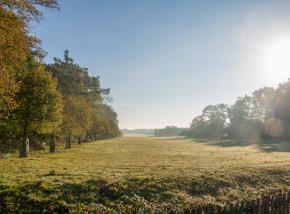
Walking Route - Houghton: 4.5 miles / 7.25km
Circling one of Norfolk’s most important Bronze Age landscapes, this route is a wonderful chance to get off the beaten track and sample high culture in the same day. Houghton Hall offers an array of outdoor sculpture in its gorgeous gardens as well as indoor art exhibitions (check opening times/season before visiting).
Unnatural History
Sir Robert Walpole, Britain’s first Prime Minister, began the construction of Houghton Hall in 1722. He considered that the existing village was too close to the new building, so he had the entire village moved. Today the new village of Houghton consists of two rows of white cottages that line The Street on the approach to the south gate, and some of the residents still work on the estate.
Walpole built the Hall to impress, and to augment his status with no expense spared. The mansion’s grand Aislaby Stone cladding, for example, was quarried in Yorkshire and shipped all the way to Norfolk. Today Houghton Hall is known as one of the finest Palladian houses in England. Walpole, however, was not the first to have an impact on the look of the local landscape.
The estate and countryside surrounding Houghton Hall is peppered with prehistoric earthworks; these Bronze Age burial mounds date back 3300 to 3500 years. Many are not immediately obvious and their sheer abundance only becomes clear when identified on maps. Some appear simply as islands of scrubby woodland, isolated in the middle of fields. Others, however, stand proud of the surrounding ground, presenting themselves as obviously man-made monuments. The area is regarded as one of the most significant Bronze Age landscape sites in Norfolk.
Traditional hedgerows still define the fields surrounding the estate. They are interrupted by numerous oak trees that grow along them at regular intervals. Much of the woodland on the estate itself, however, cannot be referred to as ancient. A notice in one records that it was planted 1964, and is populated by a mix of fast-growing conifers and sycamore as well as some oaks younger than those found elsewhere on the estate.
The farms and estate have provided jobs for generations of locals. A memorial plaque outside the south gate of Houghton Hall is dedicated to the lives of three servicemen from the village who died in the First World War: gamekeeper Arthur Snell, Herbert Ramm and Reginald Callaby who had both worked as farm labourers before they went abroad to fight for their country.
Houghton Hall Circular Walk takes a route from the south gate, out along hedge-lined paths, through agricultural land via Peddars Way - itself an ancient feature of the landscape - and alongside several well-preserved Bronze Age burial mounds, before returning through mixed woodland and parkland.
Walking Route - Hunstanton: 3.75 miles / 6km
Linked by a series of clifftop greens and gardens, this circular route combines the hubbub of Hunstanton and the relative quiet of its much older neighbour, Old Hunstanton. The two settlements offer a truly wide variety of options for food and drink, to suit all tastes and budgets.
A Victorian Vision
Hunstanton is famous for its dramatic striped cliffs and for being one of the few places on the east coast of England where the sun can be seen setting over the sea. Before 1840 though the town did not exist. Only a few buildings, such as the ruin of St. Edmunds Chapel and Hunstanton Lighthouse, stood between the village of Old Hunstanton to the north and Heacham, four miles to the south.
The development of ‘New Hunstanton’ as a seaside destination was the vision of the Victorian landowner, Henry Styleman Le Strange. Today, a life-size statue commemorating him stands on Upper Green, almost directly opposite the first building that was constructed in the town, the Golden Lion Hotel (originally the New Inn).
The statue depicts the Victorian landowner with a train track running around his feet. Le Strange petitioned for the railway to reach Hunstanton from King’s Lynn, and eventually his persistence paid off. Hunstanton Railway Station opened in October 1862. Le Strange did not witness the opening, however, nor the prosperity it would bring – he died in July of the same year. His son, Hamon Le Strange, was instrumental in fulfilling his father’s ambitions.
Henry Styleman Le Strange is buried in the churchyard of St. Mary’s in Old Hunstanton where he shares a private plot with other members of his family, including his son Hamon. Hunstanton Hall, which stands nearby, was the family seat until 1949. It has now been divided into a number of private apartments. The Esplanade Gardens, designed by the head gardener of Sandringham House, opened around 1880. The bowling greens, the Cenotaph war memorial and several themed displays have been developed since.
Hunstanton Circular Walk is not signposted on the ground, but it easy to follow with a map. It leads from Le Strange’s statue at Upper Green, along North Promenade, up toward the cliffs. It then follows the route of the Norfolk Coast Path, past the ruin of St. Edmunds Chapel and Hunstanton Lighthouse. Coming through Old Hunstanton it visits St. Mary’s Church before returning to Hunstanton via the Esplanade Gardens.
Walking Route - Ken Hill: 2.25 miles / 3.75km
Spanning from the village of Snettisham, this short but charming walk takes a route which snakes through the mixed woodland of the Ken Hill Estate. The western tip of the route commands fine views over the estate’s farmland and the Wash beyond.
Age of Iron, Torcs of Gold
In November 1948 a field near Snettisham was being deep-ploughed for the first time. Previously a lavender field, it was being prepared for a crop of barley. Tractor driver Raymond Williamson’s plough struck a large metal object and assuming that it was a bit of old brass bedstead, he placed it on the edge of the field where it lay for several days. Experts from Norwich Castle Museum were only contacted after several more artefacts were uncovered. They immediately identified them as Iron Age torcs made from gold.
Torcs are decorative neck-rings and were probably worn by eminent members of Iron Age communities to indicate their status. They would have been highly prized objects.
Williamson’s discoveries had already become known as the ‘Snettisham Treasure’ when just two years later, in 1950, ploughman Tom Rout unearthed another torc, just fifty yards away from the site of the original discovery. This torc was massive, a whole kilogram of expertly crafted gold. Now known as the ‘Great Torc’, it is on permanent display at the British Museum in London.
Over subsequent decades, a dozen or so further major finds were made in the area. Collectively, the Snettisham Treasure now consists of around two hundred torcs, over a hundred bracelets and about two hundred and thirty coins with a combined weight of over forty kilos. While torcs have been retrieved from Iron Age sites across Britain, more have been found in Norfolk than in any other county, and more have been found in Snettisham than anywhere else in Norfolk. The Snettisham Treasure is renowned as the largest assemblage of Iron Age gold, silver and bronze objects found in Europe.
The Ken Hill Circular Walk takes a route around Lodge Hill Plantation on the Ken Hill Estate, passing the site of a medieval tower. Now surrounded by trees, the tower would once have commanded extensive views over the Wash.
Walking Route - Leziate: 4.75 miles / 7.75km
This peaceful route passes between the sleepy villages of Leziate and Ashwicken, where a history of industrial sand extraction has left the area with a series of artificial lakes. What it may lack in facilities the walk more than makes up for in rural charm.
Vestiges of Villages
Medieval villages in north-west Norfolk were vibrant places. People relied on land and livestock for their everyday needs, and they were busy all year round, sowing seeds, harvesting produce, rearing animals and rejoicing during festivals. However, major changes in farming practices during the Tudor period had a dramatic and detrimental effect on this landscape of agriculture, with many communities disappearing completely around this time.
Holt House is the only reminder that the village of Holt, near Leziate, ever existed. Holt became depopulated after Thomas Thursby, a local landowner, enclosed the traditional open field system to create pasture for his sheep. Enclosure involved fencing off areas previously used as common land, meaning that villagers could no longer use these areas to graze their own livestock.
Wool production was very profitable in the medieval period and many arable fields were also converted to provide grazing areas for flocks. Conversion of arable land to pasture drastically reduced the workforce needed on farms. Faced with the twin pressures of lack of land and livelihood, the villagers of Holt had little choice but to leave their homes and search for employment elsewhere.
Thomas Thursby was also a major landowner around Glosthorpe. A search for Glosthorpe on modern maps would be in vain; all that remains are cropmarks outline the layout of the erstwhile village in nearby fields to the south-west of All Saints’ Church.
Once the original core of the community of Ashwicken, All Saints’ Church now stands alone among fields. It is home to several ancient memorial slabs. Commemorated here, for example, is John Drury, a gentleman who resided at Holt House until his death in 1653.
The Leziate Circular Walk passes from a landscape pock-marked by modern sand quarries around Leziate – some of which have become lakes – into countryside still dominated by farmland. The populations of both Leziate and Ashwicken since the medieval period, but unlike some of their neighbours, they have not vanished entirely. They are now united into a single parish. All Saint’s Church is on the route and is usually open to visitors during the day.
Walking Route - Ringstead: 7 miles / 11.25km
This is the longest of the Coastal Treasures walks. The sense of remoteness that exists along this walk’s green and pleasant lanes is a wonderful experience for the more adventurous walker and the perfect excuse to indulge in some great local food afterwards.
Evolution and Agriculture
For the majority of its history, farming provided the population of Ringstead with its primary source of employment, as was the case for most rural communities across north-west Norfolk. The village sign represents this with a tractor at work in a field.
Great Ringstead School was built in 1852. The log books indicate several pupils were routinely absent owing to other commitments. An entry from 1866 records a particularly extreme example: ‘Every child in the 1st Class Register absent this week working in the fields and at home.’ The school closed in 1985 and has since been converted into a residence.
Modern agricultural technology and techniques have greatly reduced labour requirements and have resulted in increased yields. Some of these innovations have been implicated in causing dramatic decreases in populations of native wildlife species, and the marginal habitat offered by hedgerows has decreased over the last half-century. Courtyard Farm at Ringstead responded to these concerns by becoming fully organic in 2000. Their main crops of wheat, barley, beans, peas and red clover are now grown using a six year rotational system.
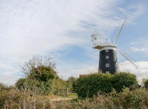
Ringstead Towermill, built around 1840, still stands, but unfortunately it has lost its characteristic complement of six sails – most Norfolk mills had just four. The mill ceased working in 1897 and was left derelict until 1927 when it was purchased by Professor Francis Cornford and his wife Frances, grand-daughter of Charles Darwin. The couple employed an architect to convert the mill into a house and in 1936 and 1937 hosted meetings of the Theoretical Biology Club in the brick base of the windmill, for those fascinated with the natural world and the complexity of life. The scientific philosopher Karl Popper described the club as ‘one of the most interesting study circles in the field of the philosophy of science.’
Ringstead Circular Walk runs along the High Street passing by the Gin Trap Inn, the Old School, St. Andrew’s Church and Ringstead Towermill. It then passes out into the countryside with some fine views over land managed by Courtyard Farm.
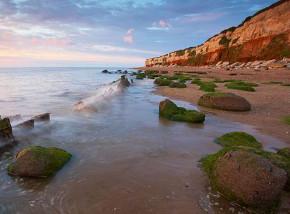
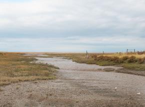
Walking Route - Snettisham: 4.5 miles / 7.25km
Crossing green grazing fields, traversing a shoreline once overwhelmed by the sea and passing through a pleasant woodland, the Snettisham circular has a wonderful variety of landscapes to enjoy. The route is best enjoyed during dry periods between late spring and early autumn.
Heroes and High Water
During the Second World War a German invasion of Britain from the sea seemed inevitable, and defences were constructed along the Norfolk coast to repel an attack that never came. In 1953 it was the sea itself that invaded, inundating the land on one catastrophic night. Many families from Snettisham were deeply affected by both the war and the flood. Ironically, it was during peacetime that disaster struck. On the night of 31 January 1953, a North Sea surge caused severe flooding across the east coast of England. The beach area of Snettisham was particularly badly hit and twenty-five people died in the flood.
Locke Hill Farm was used as a base of operations for some of the rescue efforts during the storm of 1953. Stanley Linge and his brothers Eric and Noel were at home. Along with PC Henry Nobbs they tied ropes to telegraph poles to help them venture out into the flood water in search of survivors. PC Nobbs later received the British Empire Medal for his bravery.
Agriculture was so vital to the war effort that some farming jobs were listed as ‘reserved occupations’, meaning that those employed in them were not required to join the armed forces abroad. Many local men, however, were still keen to play their part and volunteered for Snettisham Home Guard. Stanley Linge, whose father Walter owned Locke Hill Farm, joined and became a Sergeant. He was issued with a machine gun and detonators to protect the coast if there was an invasion. He and other men trained locally and guarded strategic points in the area. The land itself also gave to the war effort, with gravel from seaside quarries at Snettisham used to build airstrips across East Anglia - including RAF Marham, RAF Great Massingham and RAF Sculthorpe in Norfolk.
Snettisham Circular Walk passes along the front at Snettisham that was inundated in 1953. It carries on up Beach Road and past Locke Hill Farm. As the route skirts the edge of the woodland on Lodge Hill there are extensive views across the fields toward the beach.
Walking Route - Thornham: 2.5 miles / 4km or 3.5 miles / 5.5km Including Spur
Thornham sits in the quintessential north-west Norfolk landscape of saltmarsh and sand flats. This route offers rich history and a vast, natural remoteness without straying too far from the comforts of cafés and pubs that offer the very best in local produce.
Timber, Iron and Coal
Two characters from Thornham’s past represent the resourceful and resilient coastal communities of north-west Norfolk. One was a coal merchant, Nathaniel Woods, the other was Mrs Edith Ames Lyde, the Lady of the Manor.
Nathaniel Woods was trading in the area at the end of the nineteenth and the start of the twentieth century. He was among the last in a long line of traders to use the port at Thornham. Documents from the 1500s for example record three ships making regular journeys between Thornham and Newcastle, arriving laden with coal and leaving with cargoes of grain. Woods and his ship, the Jessie Mary, made their final voyage in 1914.
Mrs Edith Ames Lyde earned a reputation as a champion of charitable works. She established a branch of the Red Cross, an orphans’ home in nearby Docking and donated generously toward the renovation of All Saint’s Church. She was also the founder of Thornham Ironworks.
The ironworks was set up in 1887 to provide local men with new skills. Mrs Ames Lyde provided the premises for the operation and paid for training. Highly decorative gates and ornaments made at Thornham soon appeared on estates and in great halls across the country, including Sandringham. The ironworks closed following the death of Mrs Edith Ames Lyde in 1914 and the outbreak of the First World War. An original example of a sign produced at Thornham Ironworks can be seen hanging outside The Orange Tree. It still advertises The Kings Head, the pub’s original name.
Thornham Circular walk takes a route past the Orange Tree and alongside All Saints’ Church, where a lych-gate is dedicated to Nathaniel Woods and his ship. It also passes the original coal barn used by Woods, which still stands as an iconic landmark.
A spur from the main route leads to the Norfolk Wildlife Trust reserve at Holme-next-the-Sea. Here the excavation of Seahenge, a Bronze Age timber circle, gained nationwide attention in the late 1990s. There are no remains of the monument on the beach. Timbers from the original structure can be seen at Lynn Museum in King’s Lynn.
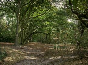
Walking Route - The Woottons: 3 miles / 4.75km
The Woottons route has good surfaces throughout and a number of bridges to help visitors through the woods of Ling Common. The spread of these suburban villages across the landscape can almost be charted by looking at the fabric of their buildings.
Suburbs and Salterns
The Domesday Book of 1086 lists Wootton as having two plough teams, one hundred and twenty sheep and fourteen saltern mounds. Salt would have been an important commodity for trade at this time, and it was extracted from saltwater by evaporation in the saltern mounds that dotted the local landscape.
Over time, two settlements emerged, each surrounding a medieval church. Old maps depict the two villages being separated by fields. In 1862 the railway reached North Wootton, which was then the first station on a new branch line between King’s Lynn and Hunstanton.
Today, North and South Wootton are virtually contiguous. While some families have lived in the area for generations, many have settled here to take advantage of good transport links to commute to work from these popular residential areas. The railway was removed in 1969 however, and the station building is now a private residence.
North and South Wootton both retain their own parish churches. All Saint’s at North Wootton has the most recent origins. It was built for the Honourable Mrs Mary Howard of Castle Rising in 1852. It replaced the original medieval church on the site which by then had fallen into ruins.
St Mary’s Church in South Wootton dates from the Saxon period, although there have been many alterations and additions since. The church still has a beautiful Norman font and a funeral bier dated to 1611.
John and Annie Sage and their family moved to the area in 1899. John became landlord at the New Inn in South Wootton. Four of their children were baptised at St. Mary’s in 1901. In 1908 they moved again, to Peterborough, had dreams of but starting a new life in the United States. In 1912, all eleven members of the family boarded a ship, the Titanic. Tragically, none of the family survived.
The Woottons Circular Walk navigates a route through modern housing developments along the edge of the wooded Ling Common, between All Saints at North Wootton and St. Mary’s at South Wootton, crossing an area previously occupied by fields and saltmarsh.
Cycle Route - Nelson Cycle Route: 18.25 miles / 29.5km
This is the longest of the cycle routes and it is to be savoured. With plenty of options for refreshment, it is easy to make a day of it while explore rolling landscapes that Nelson himself once knew. It is easy to see why he gloried in being a Norfolk man.
War and Peace
West Norfolk proudly celebrates its connection to the naval hero Admiral Lord Nelson. After many famous victories he died at the Battle of Trafalgar in 1805. His father, Edmund Nelson, was rector of All Saints’ Church at Burnham Thorpe when his son was born at the parsonage on 29 September 1758. Today, many objects displayed inside the church celebrate Nelson’s life and career.
Nearby Burnham Market incorporates the formerly separate villages of Burnham Ulph, Sutton and Westgate. The amalgamation of their boundaries resulted in the sites of five churches being located in one parish. While nothing remains of two of these churches today, the ruins of St. Ethelbert’s at Burnham Sutton are visible and both St. Mary’s at Burnham Westgate, and All Saints’ at Burnham Ulph still stand and are used regularly.
An Iron Age fort at Bloodgate Hill in South Creake has been identified by archaeologists as one of only six such sites in Norfolk. A local legend, that a battle between Danes and Angles was waged on the hill, is depicted on the village sign.
The village of Stanhoe was the site of a Wellington bomber crash during World War Two. It went down near Stanhoe Hall in 1943.
The villages of Great and Little Barwick provide a peaceful contrast to these stories of military land, sea and air campaigns. Both places are thought to be smaller now than they were during the medieval period.
Beautiful Creake Abbey once dominated the parish of North Creake. Starting as an Augustinian house in 1206 it became an abbey in 1225. Following the death of the last abbot in 1506 the buildings fell into ruin.
The Nelson Loop passes the site of Lord Nelson’s birthplace, which is marked by a plaque. It visits the churches at Burnham Thorpe and Burnham Market, and the ruins at Burnham Sutton. It then heads north to the coast before returning south through Stanhoe and Great and Little Barwick before heading to South and North Creake.
Cycle Route - Ringstead & Bircham: Ringstead 17miles / 27.25km Bircham 6.5miles / 10.5km
Both routes take in quiet lanes and tracks across a landscape of low chalk hills which afford glorious coastal views. With a pub in each village on the longer Ringstead route, it is perfect for leisurely exploration. The shorter Bircham route is ideal for families.
Rural Rags, Rural Riches
West Norfolk has been home to notable politicians, distinguished ladies and brave sea captains. Throughout history though, the reality of life in rural areas has often been harsh. The plight of agricultural workers who relied on seasonal employment could become especially desperate during the winter months. In 1834 the Poor Law mandated that paupers in Britain should be accommodated in workhouses, where they were expected to work in exchange for food, clothing and care.
In 1836 a new workhouse was built west of Docking for the Docking Poor Law Union. A children’s home in the village was opened at around the same time with the support of Mrs Edith Ames Lyde, Lady of the Manor at Thornham.
While the workhouse had a maximum capacity of four hundred and fifty people, the records show just eighty-six inmates. Ages vary from a few months old to an individual in their eighty second year. Listed as ‘paupers’, the inmates would have had a structured day-to-day life and received training in various professions. Living conditions would have been very basic.
Near Fring, a hoard of gold Iron Age coins was discovered on the site of a later Roman villa. Another hoard of twenty gold Iron Age coins hidden inside a cow bone was found at Sedgeford.
The village of Sedgeford itself is now associated with archaeology thanks to the Sedgeford Historical and Archaeological Research Project (SHARP), a wonderful project that brings in experts and enthusiasts alike from around the globe to dig and investigate the periods of human settlement in the village (open to visitiors in July and August, see www.sharp.org.uk).
A more modern feature that has already disappeared is the railway. Sedgeford station is now a private residence, and the owners have retained one of the old level crossing gates. The Ringstead route crosses the route of the old railway and visits the villages of Docking, Fring and Sedgeford. The workhouse still stands on Heacham Road to the west of Docking, slightly off the main route. The orphanage at Docking is now a private house on Fakenham Road called Lyde Cottage.
Cycle Route - Sandringham Cyle Route: 14.75miles / 23.75km
From a Norman Castle to a modern royal estate, there is barely a moment of this journey that does not conjure some wonderful sight from the distant or recent past. The Sandringham visitor centre is the perfect starting point for the adventure. The route is suitable for any type of bicycle.
Royalty and Remembrance
The Sandringham route begins with a loop to the south, visiting Castle Rising and crossing the Babingley River on the way out and back. St. Felix sailed up this river before introducing Christianity to East Anglia in AD 615, a story immortalised on Babingley’s village sign.
Castle Rising’s castle itself and the Church of St. Lawrence were built in the 1150s. In the 1300s the castle was home to Queen Isabella after her possible involvement in the murder of her husband, King Edward II. Other buildings in the village of Castle Rising, such as the cottages at 20 and 21 Low Road and Trinity Hospital, an almshouse, are post medieval and date from the 1600s.
Returning to the Sandringham estate and the more recent past, the route passes the Norwich Gates at Sandringham, which were originally constructed for the Great Exhibition of 1862. Looping out via West Newton and Anmer churches, the route returns through the heart of the estate, past the War Memorial.
The Sandringham estate was purchased by the Prince of Wales, later King Edward VII, in 1862. Sandringham House, built shortly afterward, re-introduced a royal retreat to north-west Norfolk. The house and estate have provided employment to locals for generations.
In 1906 Frank Beck, the land agent for King George V, formed the Sandringham Company of Volunteers. Despite being over ifty years old during World War One, Captain Beck insisted on accompanying his men on active service. As part of the 5th Battalion, Norfolk Regiment, Beck’s men took part in the disastrous invasion of Gallipoli. Reports received at Sandringham stated that they had gone missing during battle on 12 August 1915. A rumour circulated later that they had disappeared into a cloud, earning them the nickname ‘the Vanished Battalion’.
Beck and his men are honoured on the lych gate to St. Peter and St. Paul’s Church in West Newton where a window depicts Beck as St. George. The Sandringham war memorial, which bears a striking resemblance to the medieval village cross in Castle Rising, lists the names of several members of the 5th Battalion.
![]()

© Visit North Norfolk 2026. All Rights Reserved